Gleeson Land Logo

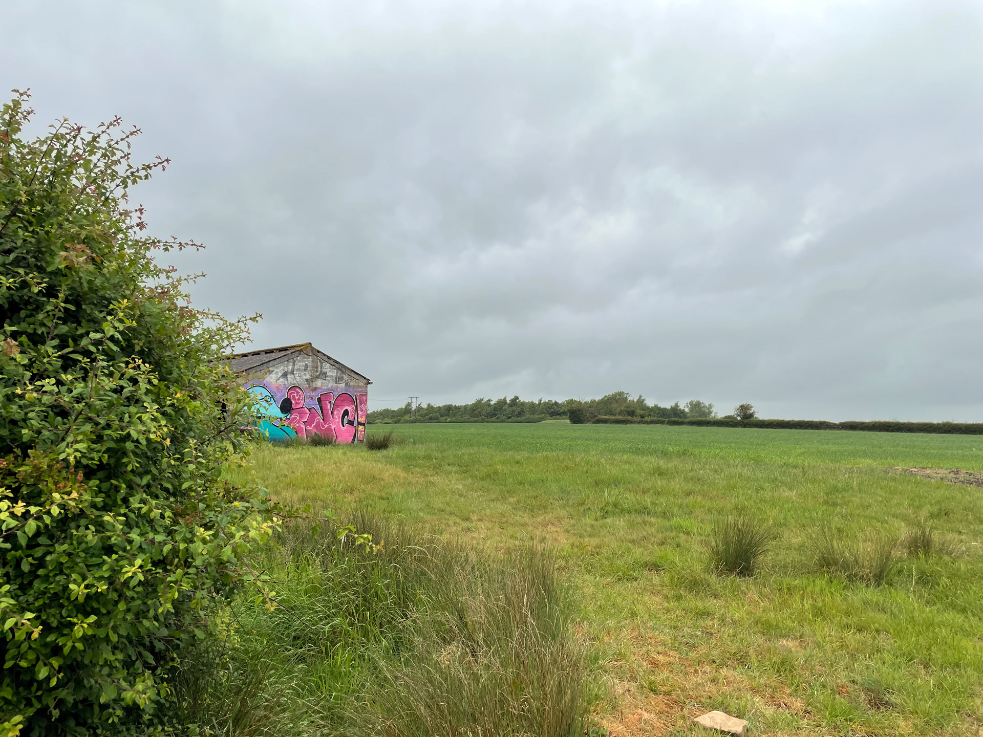
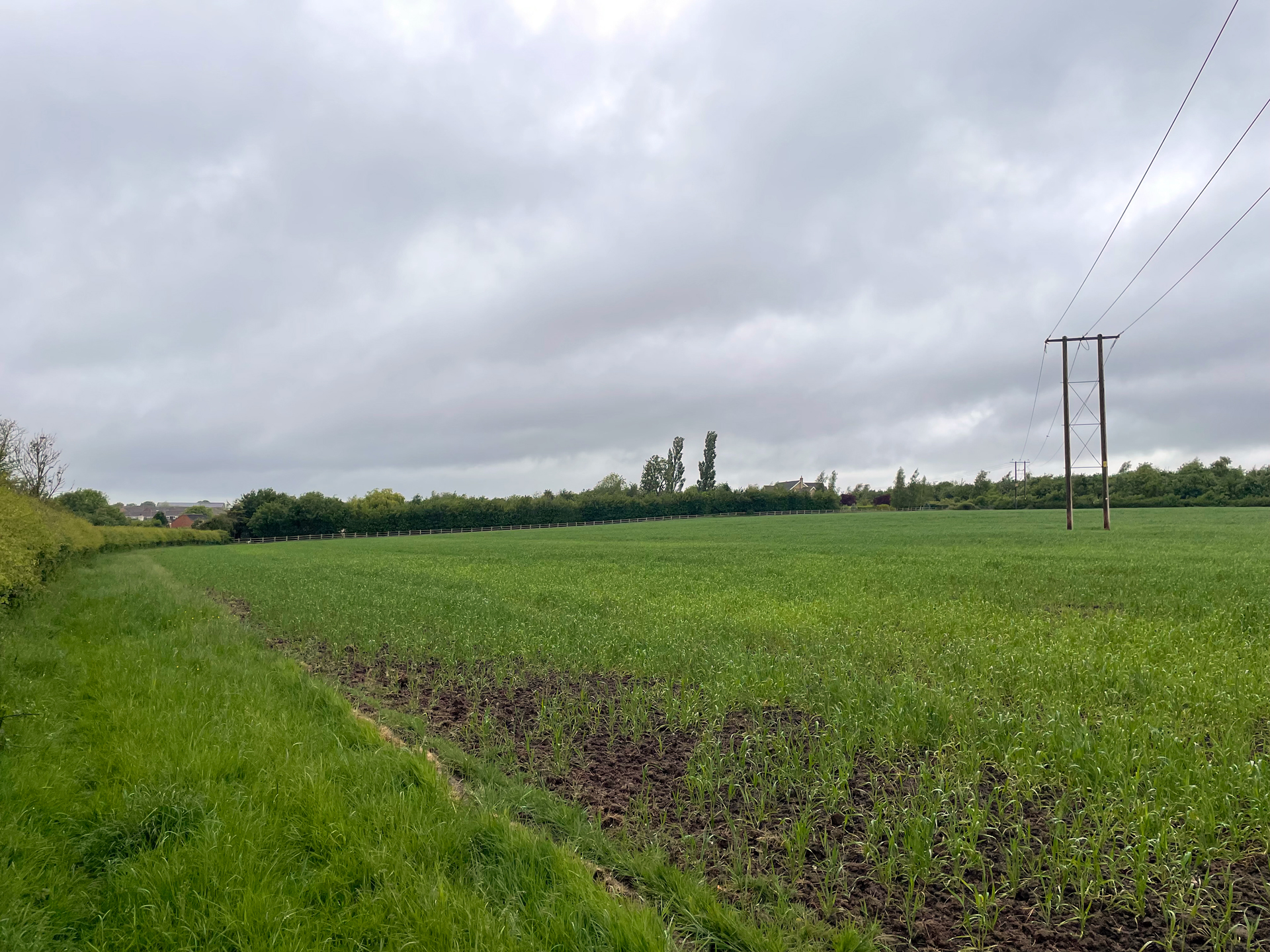
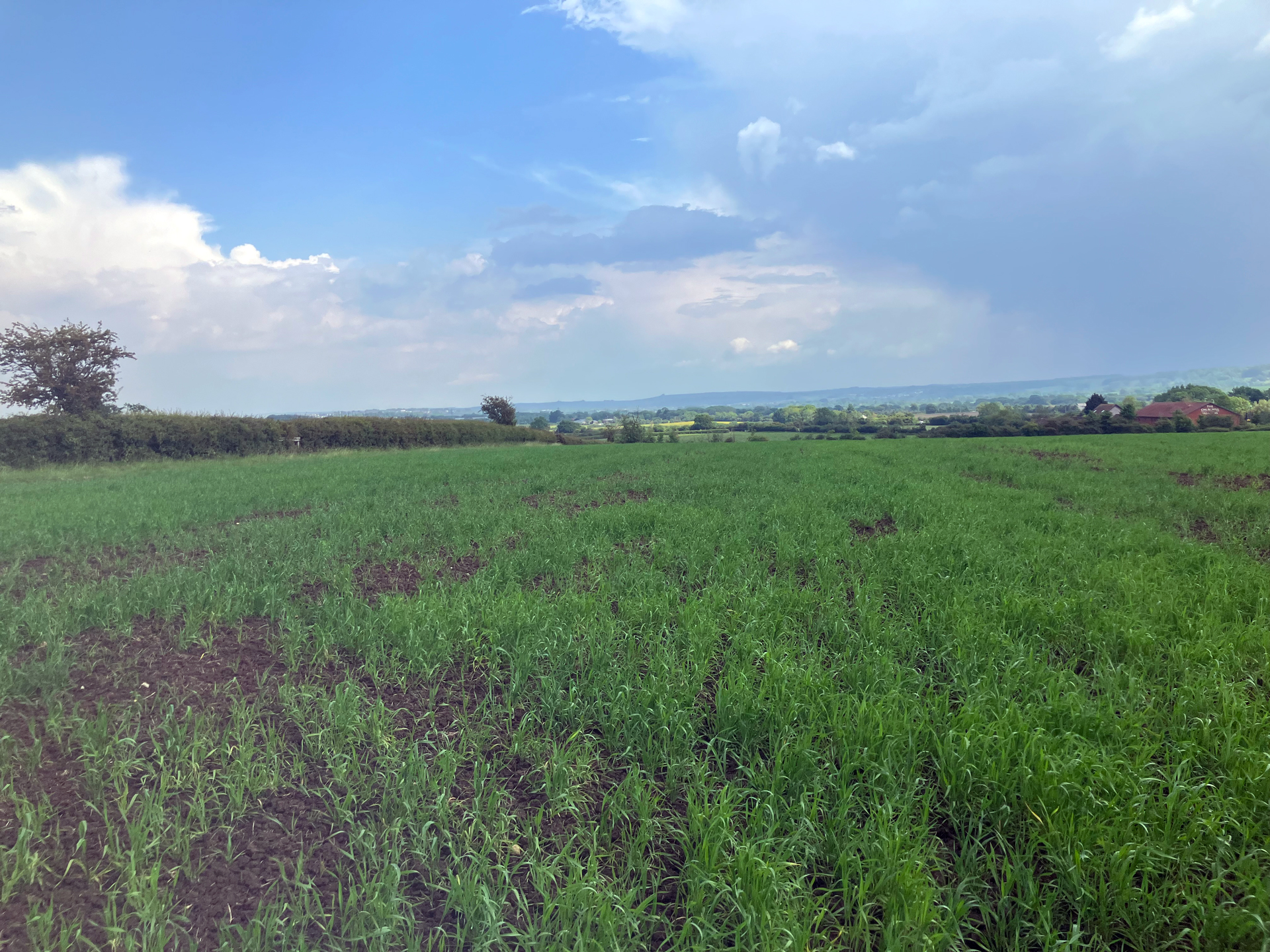
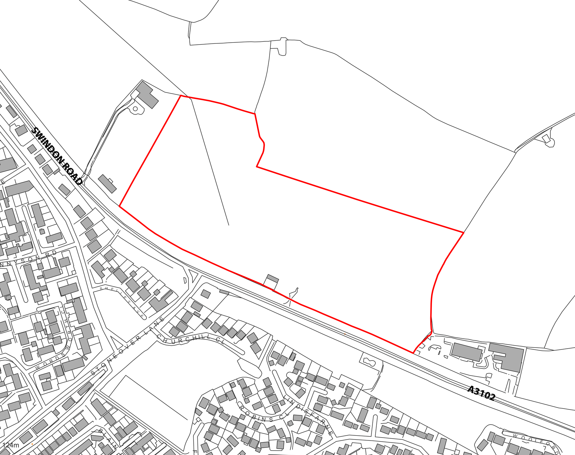
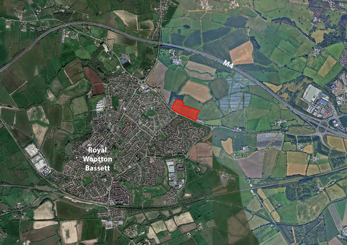
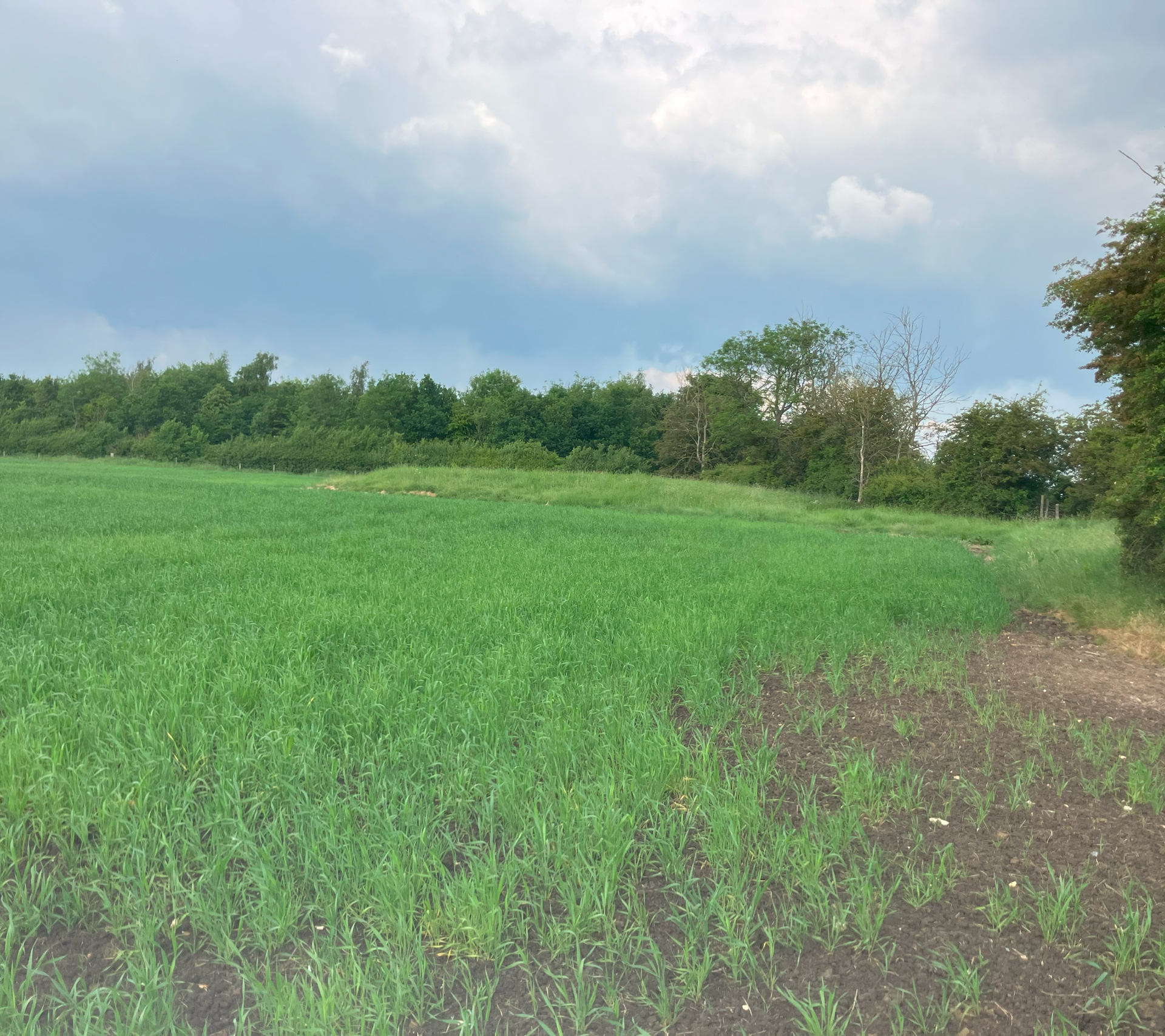
Land North of Swindon Road
Royal Wootton Bassett

Welcome to our website and thank you for showing interest in the potential development of the land to the north of Swindon Road, Royal Wootton Bassett.

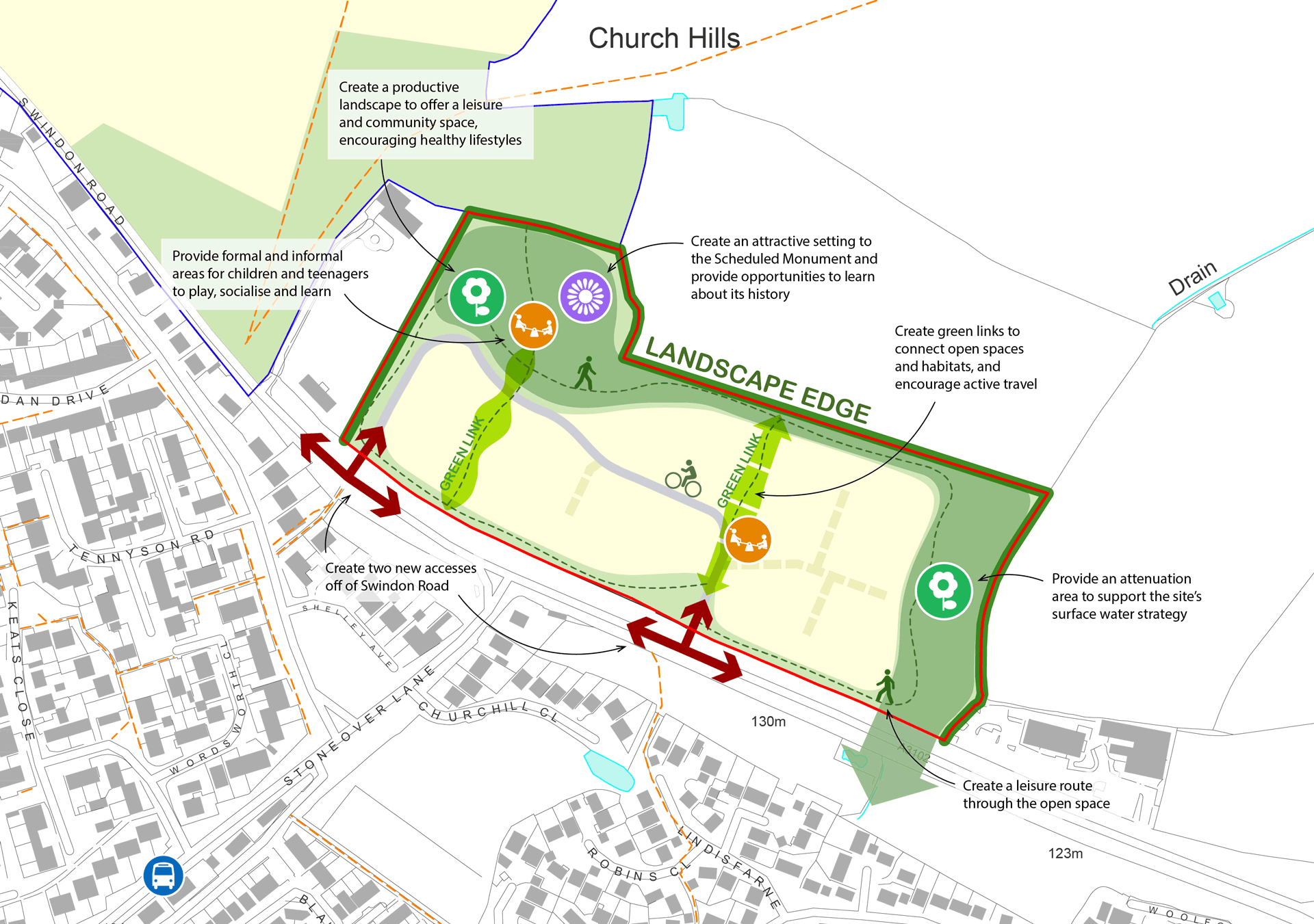
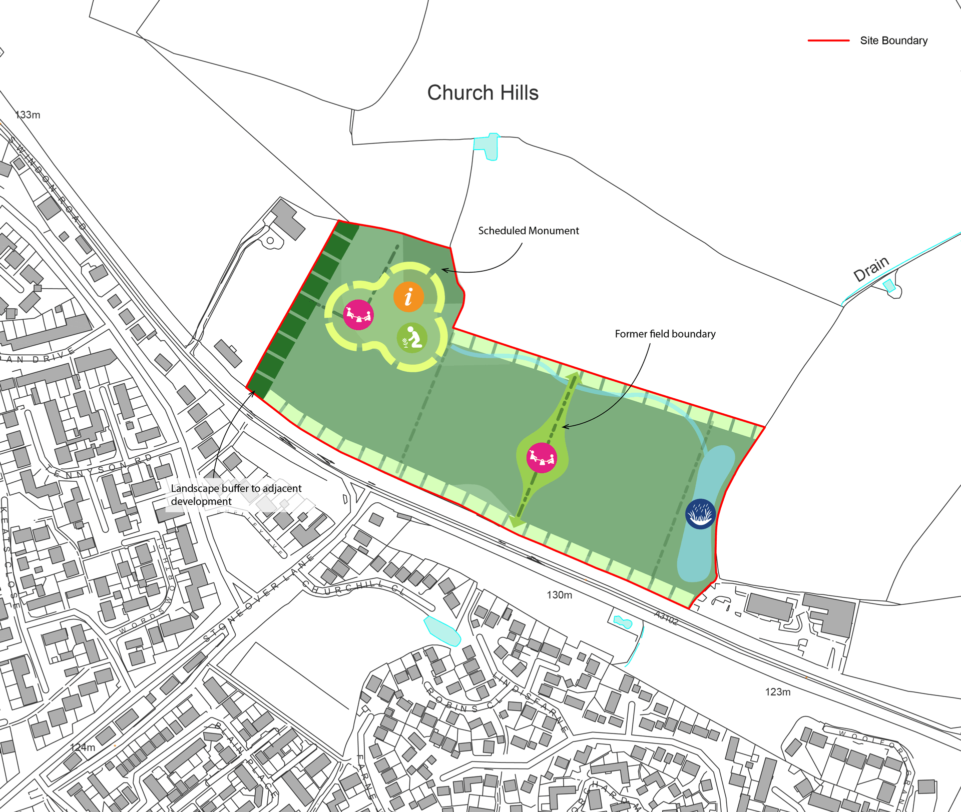
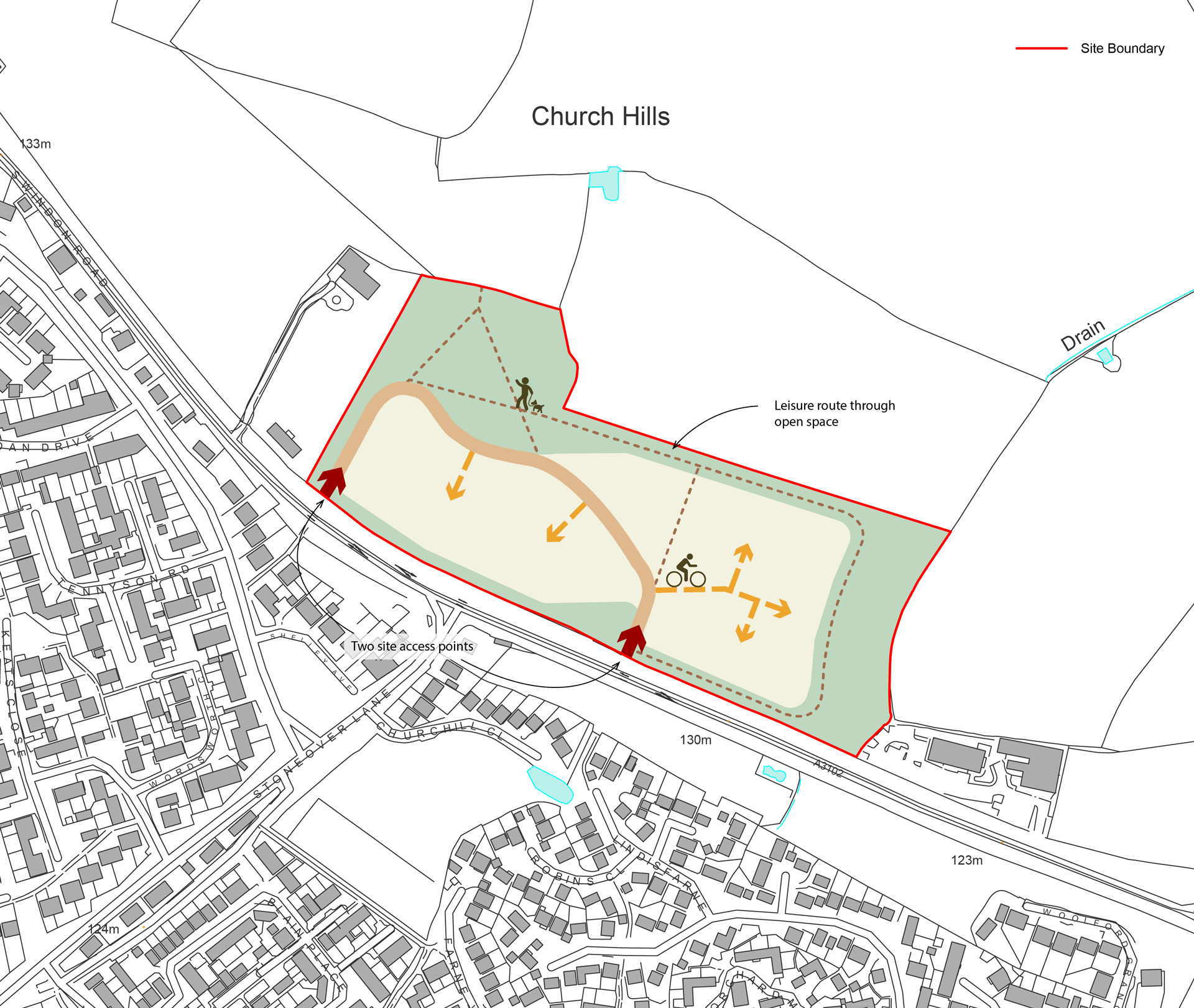
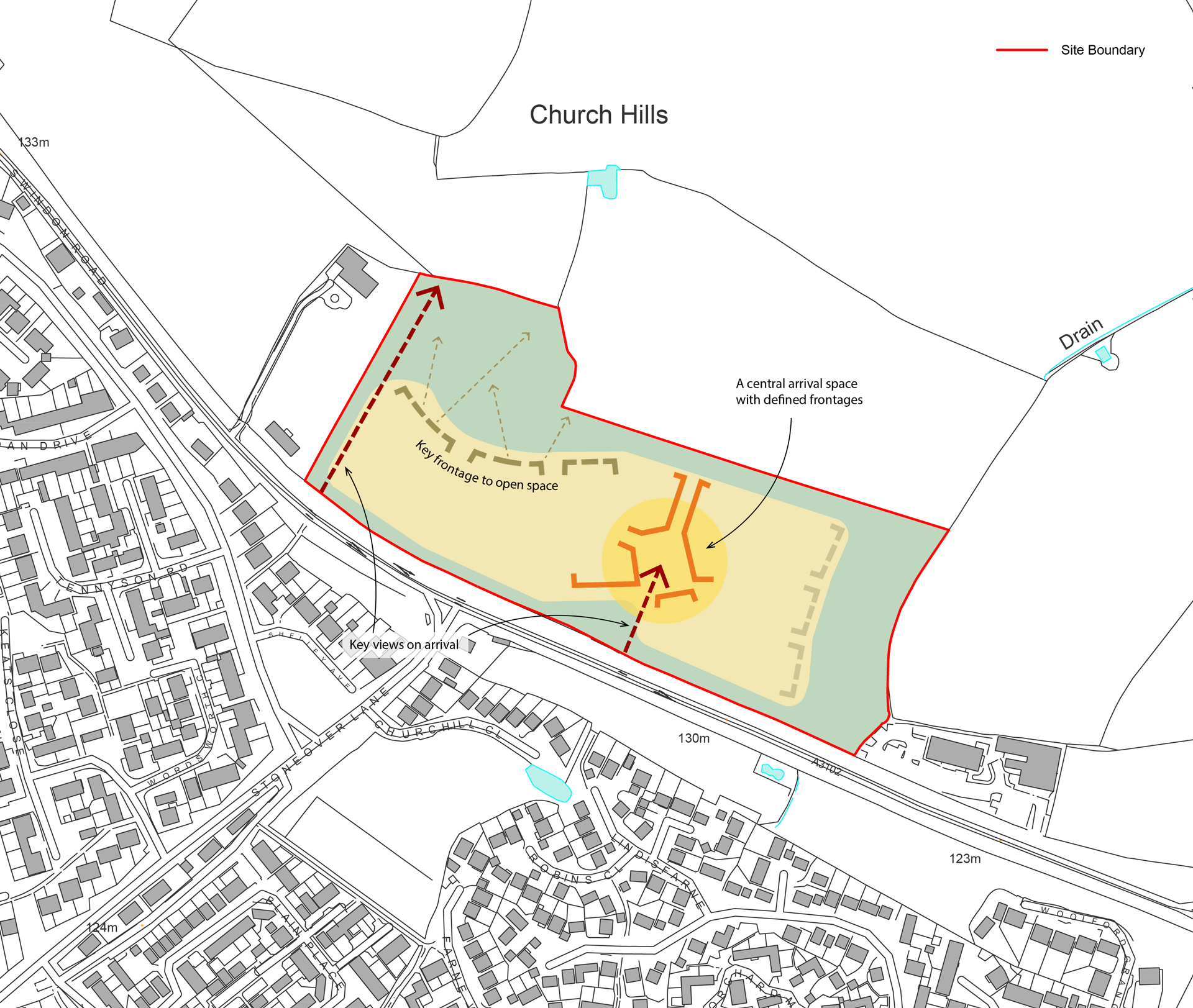
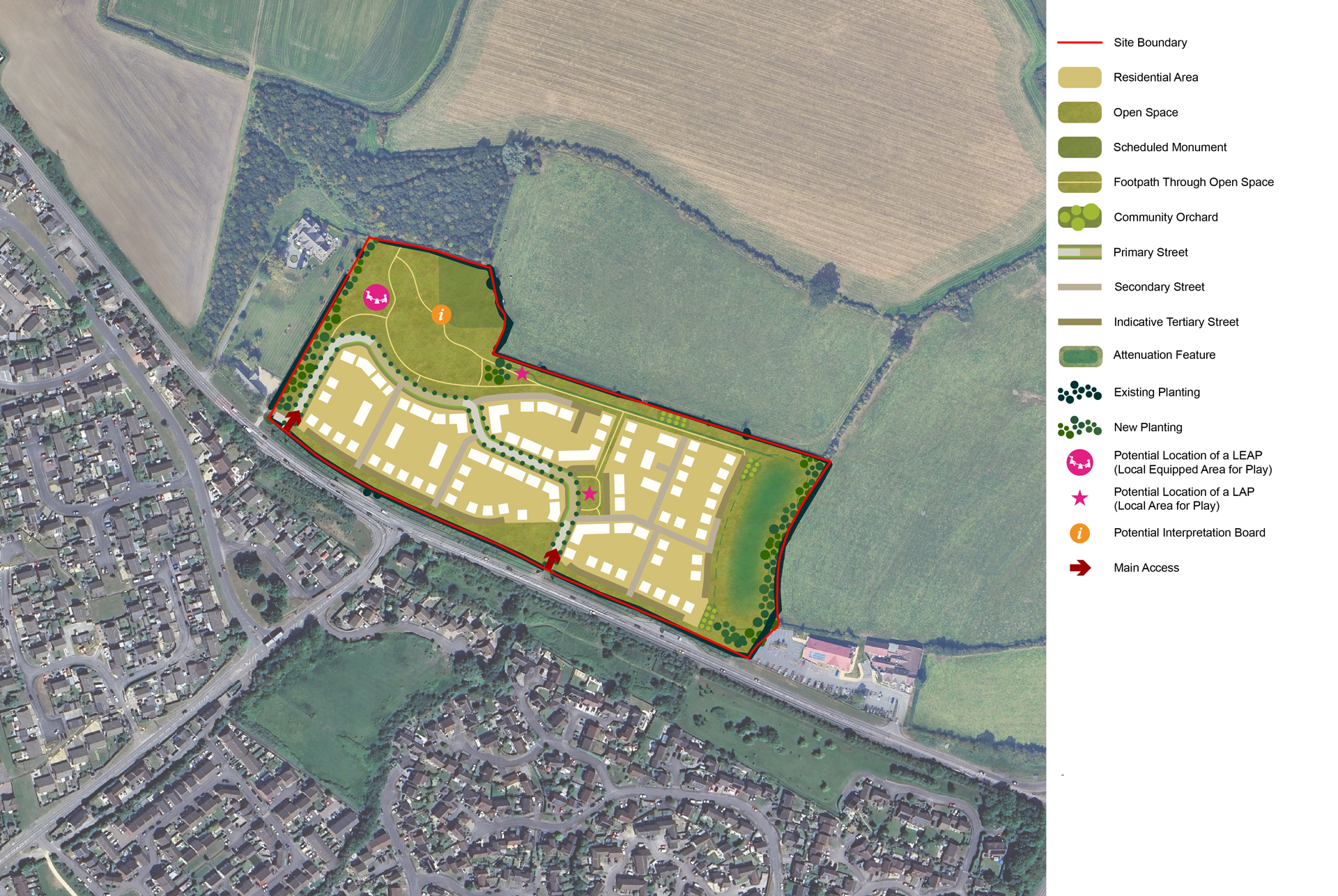
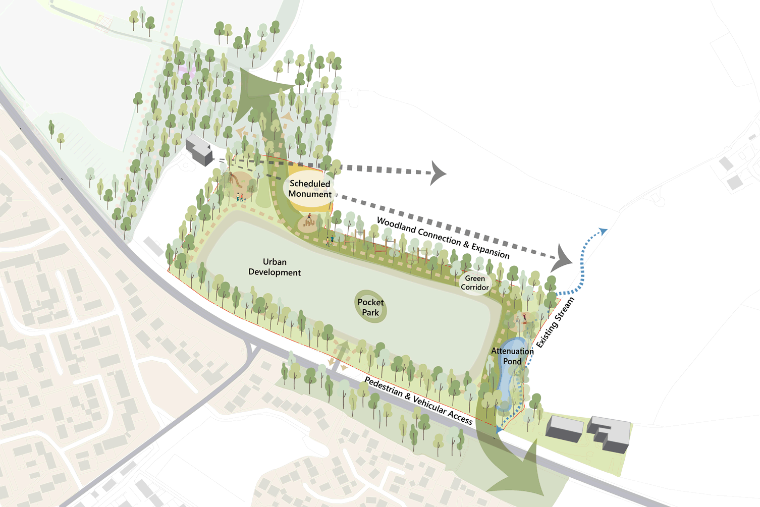
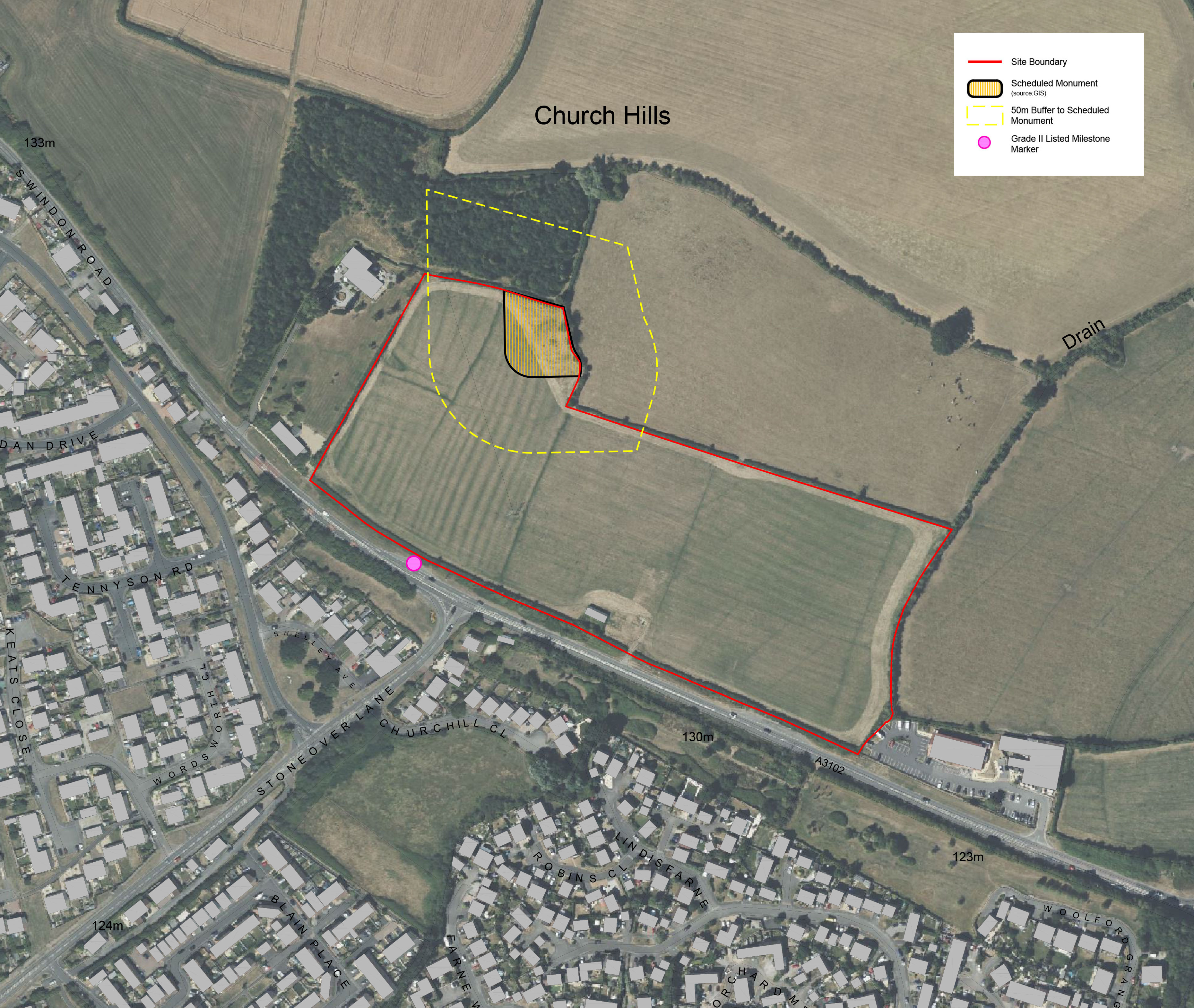
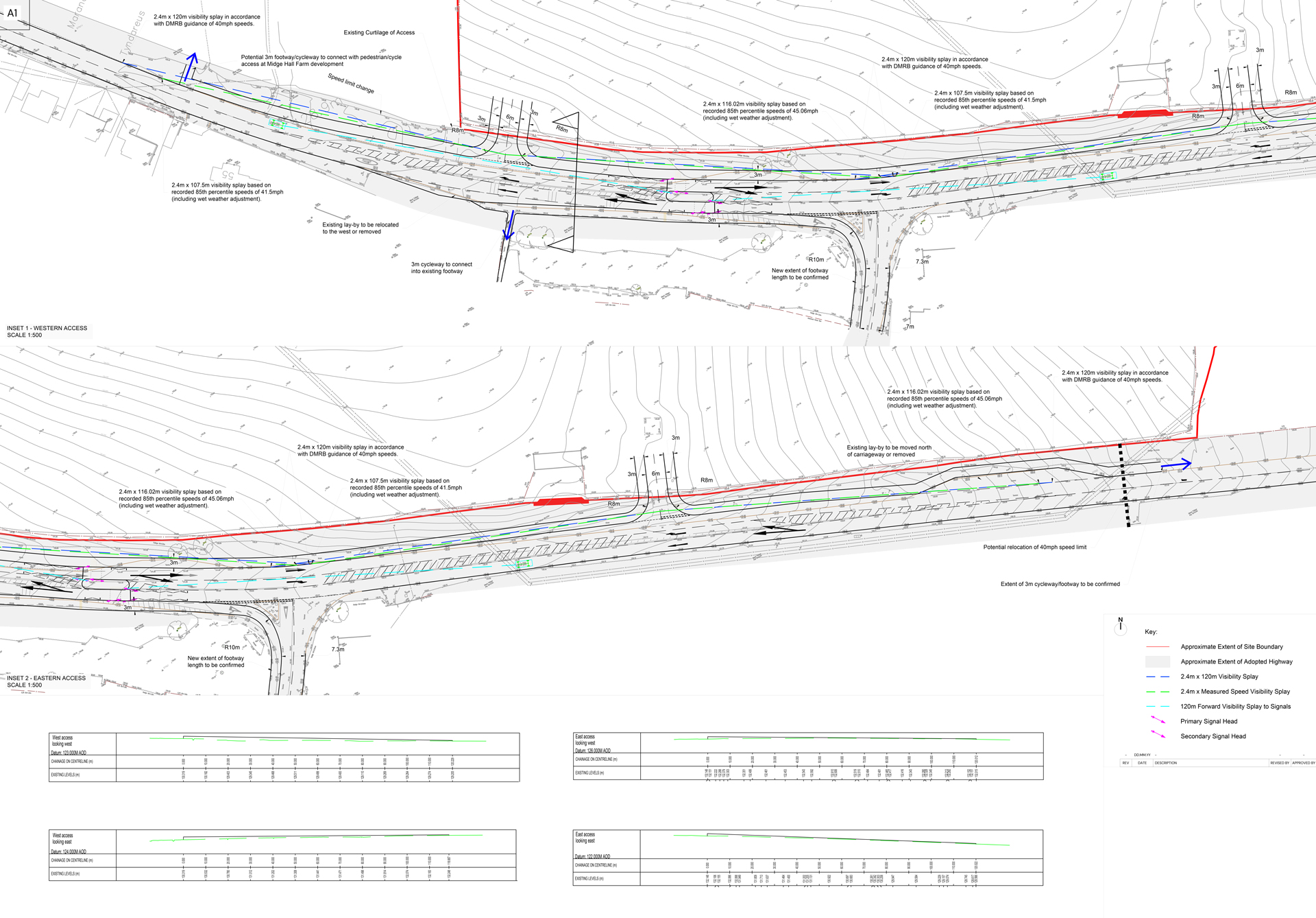
Our vision for the land north of Swindon Road is to create a well-connected sustainable new community. This site forms a natural extension to the proposed development at Land at Midge Hall Farm, which will deliver new homes, employment opportunities and a primary school. As an extension to that growth, this site could bring forward up to an additional 135 high quality new homes, with a mixture of property types and sizes.

Gleeson Land and the project team are keen to hear your feedback and hope this website provides the information you need to understand the detail behind the proposals. The consultation is running from 10th July until 25th July, with details of how to make comments provided in the Have Your Say section of this website. There will be a further opportunity to make comments directly to Wiltshire Council when the planning application is submitted later this year.

Background

Gleeson Land is a specialist land promotion business. Established in the 1990s, Gleeson Land is part of the MJ Gleeson plc which has been creating new homes and community facilities for local people for almost 120 years.

Gleeson Land is committed to realising the development potential of land in sustainable locations to provide high quality new homes in attractive environments where people want to live and relax. They are passionate about making a difference through creating sustainable places and will apply these same core principles to development at this site.

Gleeson Land Logo

Site Location

The site is situated to the northern edge of Royal Wootton Bassett.

The land is bounded by Swindon Road to the south, Elmcroft House to the west, a woodland and a livestock grazing field to the north, and an agricultural field and Churchill Hotel and Pub to the east. The site is approximately 6 hectares (15 acres) in size. It has been used as agricultural land and there is one existing agricultural farm building located along the southern boundary.

  • Existing site photo

    Existing site photo

  • Existing site photo

    Existing site photo

  • Existing site photo

    Existing site photo

Site Location Plan
Site Location Plan (Click to Enlarge)
Wider Site Context Plan
Wider Site Context Plan (Click to Enlarge)

Planning Context

Local Housing Need

There is a pressing need for both market and affordable housing in Wiltshire. Under the Government’s revised National Planning Policy Framework, local authorities are now required to fully meet their identified housing needs. In Wiltshire, this means a significant increase in the annual housing requirement - from 1,917 to 3,525 dwellings per year.

But this is not just about targets. Delivering these homes is vital to ensuring that local people have access to the housing they need, and to tackling the growing issue of affordability across the county.

The land north of Swindon Road is considered a sustainable location for new development. It benefits from good access to a range of local facilities and services, many of which are within walking or cycling distance for future residents.

As outlined below, the site is relatively unconstrained in environmental terms and offers the opportunity to deliver a well-designed mix of modern homes that respond directly to local housing needs in a sustainable location.

Image of National Planning Policy Framework Document

Vision & Key Development Principles

The site provides an opportunity to create a sustainable and attractive extension to the market town, inspired by the context and local character of Royal Wootton Bassett and building on the site’s unique landscape features.

Design Opportunities
Design Opportunities (Click to Enlarge)

Landscape & Nature

A network of greenways, open space, SuDS and existing vegetation will form the landscape framework for the site.

A central green corridor, following the alignment of a historic field boundary, will connect the north and south greenways and provide a focal space for the community. Play, trails, recreational routes, meadows, and seating areas are proposed in the vicinity of the Scheduled Monument with potential for wider pedestrian movement and Green Infrastructure connections to the North West.

Landscape Plan
Landscape and Nature Concept Diagram (Click to Enlarge)

Local Movement

Direct pedestrian and cycle connections will be created within and across the Site.

A key component of this will include a leisure route through the open space. Two site access points from Swindon Road, along the southern boundary, will enhance vehicle permeability within the Site. The western access will also include a crossing of Swindon Road, which will provide access for pedestrians to wider community and local services and facilities within Royal Wootton Bassett.

Movement Plan
Local Movement Concept Diagram (Click to Enlarge)

Placemaking

Defined frontage and built form at the eastern access will create enclosure to the central green space, providing a sense of arrival within the Site.

In contrast, long distance views to the northern open space will be offered at the western access. Along the northern and eastern edges of development, buildings will be oriented to overlook the open space to provide an attractive outlook and natural surveillance. Landscape proposals integrate a connected network of open spaces, naturalistic play areas and retained vegetation. Character areas include a pocket park, water meadows and woodland edges - designed to enhance biodiversity, frame key views and promote access to nature.

Placemaking Plan
Placemaking Concept Diagram (Click to Enlarge)

Emerging Proposals

Our emerging masterplan shows how we think the new homes, access routes and public open space could be delivered within the site.

Development Framework Plan
Development Framework Plan (Click to Enlarge)

We are still in the early design stage but currently our initial plans could provide:

  • Up to 135 new homes, offering a range of dwelling types, sizes and tenures to help create an inclusive new community
  • A responsive design that reflects local distinctiveness and sits comfortably within the current vernacular and landscape context of the Site
  • Homes built to Future Homes Standards
  • A sustainable development responding to the core principles of the National Planning Policy Framework (NPPF)
  • A site that is well connected and designed to encourage and support walking and cycling, with strong links to existing Public Rights of Way, local services and facilities
  • A new landscape edge to the northern and eastern boundaries will create a gradual transition from development to the surrounding countryside
  • Where possible, existing landscape features will be retained and enhanced within public open space, to help development blend positively into the town and character of the site
  • A landscape strategy that sensitively integrates the Scheduled Monument into the open space, offering a distinct local feature

Landscape and Ecology

The landscape strategy shapes a development that is both ecologically responsive and community-focused.

It incorporates sustainable drainage features, retains key hedgerows, integrates woodland edges and enhances a green network anchored by the Scheduled Monument - creating opportunities to support habitat corridors and promote long-term biodiversity. The proposals include a pocket park and play opportunities distributed across the site, delivering a diverse, inclusive and nature-based environment. A network of paths, trim trails and seating areas further contribute to a multifunctional and resilient landscape that encourages active lifestyles.

Landscape Concept Plan
Landscape Concept Strategy (Click to Enlarge)

Heritage

Scheduled Monument

A Scheduled Ancient Monument, identified as the remains of a Postmill (traditional windmill), is located in the far northeastern corner of the site. This designated heritage asset is of national significance, and the proposed development has been carefully designed to safeguard both its physical integrity and its wider setting. No development is proposed within the boundary of the monument itself.

A 50-metre buffer zone will be established around the monument to protect its immediate context. Within this buffer, no built form will be permitted. Instead, the area will be designed as publicly accessible open space, incorporating a play area, pedestrian and cycle routes, and landscaping that respects the monument's character.

An interpretation board will be installed within this space to provide information on the Scheduled Monument and its historical context, enhancing public understanding and appreciation of the site's heritage value.

The closest designated heritage assets to the site comprise the grade-II listed Milestone located opposite Noremarch Road (NHLE number 1283221), as well as The Marsh (NHLE number 1363676) and Midge Hall (NHLE number 1283141), both also grade-II listed.

  • Photographs of Heritage Features

    Photographs of Heritage Features

  • Photographs of Heritage Features

    Photographs of Heritage Features

Access and Pedestrian Accessibility Context Plan
Heritage Features (Click to Enlarge)

Access & Transport

Access

Vehicle access to the site will be from two access points on the A3102 Swindon Road.

Pedestrian & Cycle Routes

An improved footpath and cycleway measuring three metres wide will be provided along the A3102 Swindon Road. This will encourage walking and cycling to and from the site.

An extension of the 40mph speed limit on Swindon Road will be undertaken in due course, subject to completion of the Traffic Regulation Order (TRO) process and in discussion with the highway authority.

To enhance safety and connectivity in the local area, new signal-controlled crossing points are proposed on both Swindon Road and Hook Road. A Toucan-controlled pedestrian and cycle crossing is planned near the site access, providing a safe route onto the proposed shared footway/cycleway adjacent to the site.

Public Transport Links

The nearest bus stops are the Shelley Avenue bus stops located on Marlowe Way. These are located approximately 350 metres to the southwest of the site and are within walking distance. These provide access to bus service '55 Gold' bus route, which runs every twenty minutes Monday to Saturday between Swindon and Chippenham.

Proposed Access Arrangements Plan
Proposed Access Arrangements Plan (Click to Enlarge)

Drainage

Surface water drainage

Surface water runoff will be sustainably managed through the implementation of a Sustainable Drainage System (SuDS) and associated features, designed to store and release runoff at a rate lower than the site's current response to rainfall. A variety of SuDS such as swales, pocket street gardens and attenuation basins will be considered as the design progresses.

Open SuDS features will be designed to accommodate the critical design rainfall event—specifically, the 1 in 100-year storm with an additional 45% allowance for climate change. These features will be strategically located to effectively manage surface water runoff and will also be capable of temporarily containing exceedance flows during extreme events, through the provision of a 300mm freeboard, ensuring continued system functionality. Additionally, the SuDS will enhance water quality, strengthen green infrastructure, support increased biodiversity, and improve the site's overall climate resilience.

Foul water drainage

It is proposed that the new homes will be connected to the mains foul drainage network. Further details will be provided as the development proposals are progressed and will be subject to consultation with the Statutory Undertaker.

Drainage Image
Surface Water Drainage Precedent Image

Sustainability

At Gleeson, sustainability means meeting the needs of the present without compromising future generations.

Sustainability is at the heart of our business, and our approach is based on our relationships with communities, people, and the environment.

We will aim to achieve this through:

  • Highly energy efficient, climate adaptable, sympathetically designed homes
  • Low carbon development from the outset
  • A secure and identified trajectory to net zero emissions over time
  • Dedicated EV charging points
  • Reduction in potable water use
  • Secure and weatherproof cycle storage
Image of car charging
EV Charging Point Precedent Image

Have Your Say

Gleeson Land takes the views of the local community seriously and would welcome comments at this stage.

If you would like to provide feedback, please complete the following short questionnaire by Friday 25th July.

We take data protection seriously. Please only provide your personal details if you are willing for them to be used by Stantec and the project team for the purpose of research in connection with this project and in order to update you on the progress of the project. Your details will be treated as confidential and will not be shared, passed on or used by any third parties and they will only be retained until the end of the planning process for the project, after which time they will be deleted. If you wish to withdraw consent to the processing of your personal data you may do so by emailing: consultation@mjgleeson.com. Please include a reference to 'Royal Wootton Bassett' in your email.

Q&A

As with any potential new development, there are often lots of questions raised by the community. We will continue to add your questions and our responses as they arise during our consultation with the community.

Up to 135 dwellings, that will provide a range of house types and sizes.

The new homes will be typically two storeys in height, with the occasional two and a half storey buildings on key corners of the development blocks.

The appearance of the new homes will be determined at a future reserved matters stage, but it is anticipated that the appearance will be informed by the context and local character of Royal Wootton Bassett.

Vehicle access to the site will be from two access points on the A3102 Swindon Road.

Parking for residents and their visitors will be provided on a plot-by-plot basis depending on the size of the dwelling (based on the number of bedrooms) and with reference to Wiltshire Council Parking Standards. Cycle parking will be provided for each plot, and provision will be made for electric vehicles as well.

Construction will be managed in accordance with a Construction Method Statement to be agreed with Wiltshire Council by condition. The Construction Method Statement will include safeguarding measures to deal with matters such as:

  • Point of access into the site for construction vehicles
  • The parking of vehicles of site operatives and visitors
  • Loading and unloading of plant and materials
  • Safety hoarding
  • Wheel washing facilities
  • Measures to control the emission of dust and dirt during construction
  • Waste recycling
  • Working hours, including deliveries
  • Large vehicle and delivery routing plan

The planning application will be submitted in the Autmn of 2025. We hope that it would be determined during the first part of 2026. If permission is granted, detailed planning permission, known as reserved matters will be required. As such we anticipate work could start on site in mid-2027. These dates are indicative only at this stage in the process and may change.

There are no major rivers near or on the Site and as such flood risk from fluvial sources is predicted to be low and entirely within Flood Zone 1 according to the Environment Agency’s Flood Map for Planning.

There is a nominal amount of predominantly low surface water flood risk associated with the ditch along the eastern boundary of the Site (i.e. only occurs during extreme 1 in 1000 year storm event). Site proposals will ensure that these areas of low surface water flood risk remain undeveloped and are maintained as green open spaces to enable these areas to temporarily flood during extreme events if required.

The surface water drainage system will be designed to capture and sustainably manage surface water runoff from the development providing a 30% improvement on the existing drainage regime of the site.

No other source of flood risk to the Site has been identified and with these measures in place the development should remain safe for its lifetime and there should be no offsite affect to neighbouring properties and land.

There could be around 60 vehicle trips during the busiest time on the road network which is between 8am to 9 am, and between 5pm to 6pm. There will also be a Travel Plan provided for the development which will provide initiatives and measures which will aim to reduce the number of vehicles going to and from the site by promoting walking, cycling and public transport use instead.

New internal roads will be provided, and pedestrian and cycle links will be created throughout the site. It is proposed to widen the existing footway adjacent to the site on Swindon Road to provide a shared footway/cycleway with new crossing facilities too.

A 50-metre buffer zone will be established around the monument to protect its immediate context. Within this buffer, no built form will be permitted. Instead, the area will be designed as publicly accessible open space, incorporating a play area, pedestrian and cycle routes, and landscaping that respects the monument's character.

Landscape elements will be low-impact, designed to respect the Scheduled Monument, and maintain views towards the National Landscape.

The scheme includes a LEAP (Locally Equipped Area for Play) and LAPs (Local Area for Play) with a naturalistic design, alongside 'play on the way' features like stepping stones, boulders, and balance logs integrated through greenways.

Sustainability targets and objectives have been set for the proposed development based on the applicant's aspirations and government guidance, the latter of which recently includes energy efficiency targets within Building Regulations. Gleeson Land is committed to ensuring that the proposed development meets national requirements for energy efficiency prevailing at the construction stage.

The details of the design of houses would need to be determined at the detailed design (reserved matters) stage.

Timeline

Thank you for taking time to read about our proposal for the land to the north of Swindon Road, Royal Wootton Bassett.

In the weeks following the close of the formal consultation period we will be analysing the feedback ahead of finalising the proposals and working towards the submission of a planning application to Wiltshire Council. Once the application is received by Wiltshire Council they will consult on the submission.

Contact

If you have any comments or questions, please contact us.

Send us a message and we will get back to you as soon as we can:

landnorthofswindonroad@torandco.com

004-pencil

By Post

If you would prefer to put pen to paper:

tor&co, Everdene House
Deansleigh Road
Bournemouth. BH7 7DU